
Before you excavate
A record search is not a subsurface investigation.
BYDA tells you what is on file. Aus-OMI images the ground — multiarray GPR, electromagnetic locating and a digital site intelligence report, with evidence attached. Based in South Australia. Working Australia-wide.
The gap
What the records miss is where the strike lives.
Before You Dig Australia returns authority and asset-owner records. It does not see plastic water, abandoned conduits, private services, voids, or anything never logged. A cable locator only hears what conducts. The rest of the ground is silent until someone opens it.
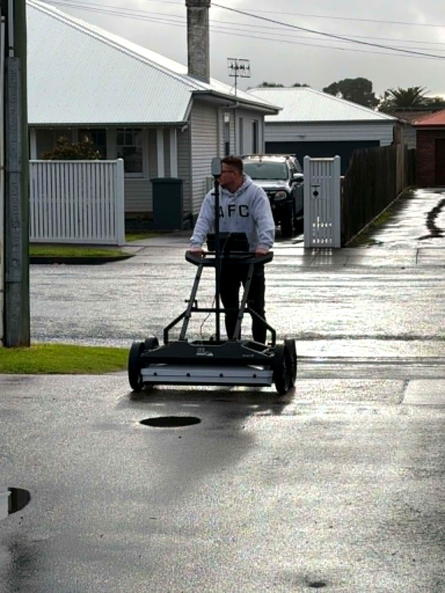
Aus-OMI investigates the site. Stream DP multiarray GPR images conductive and non-conductive features. Electromagnetic locating cross-checks live conductive services. Reality capture locks both to the world as it is. Coverage, quality level and unknowns are written down — not implied.
The handover is a digital site intelligence report and the spatial package behind it: PDF, interactive 3D, KML, point cloud, metadata. Marks on the ground are not the product.
Questions we are asked
Before the first bucket.
- Is a BYDA / Before You Dig enough before excavation?
- No. BYDA returns what authorities and asset owners have on record. It does not image the ground. Non-conductive pipes, abandoned services, private assets and unknown infrastructure often never appear. Aus-OMI investigates the site and issues a digital site intelligence report — with coverage, evidence and residual unknowns stated.
- What is multiarray GPR and why not only a cable locator?
- A cable locator hears conductive services. Multiarray GPR images the ground itself — plastic, concrete, voids, unknown trenches, depth-separated utilities. Aus-OMI deploys the IDS Stream DP as the primary layer, then uses electromagnetic locating to cross-check conductive services in the same model.
- What is AS 5488 quality level on an Aus-OMI report?
- Quality level is the evidence source for each feature: records, surface correlation, geophysical detection, or exposed verification. It is assigned feature by feature. GPR or SLAM alone does not establish QL-A. Interpretation confidence and positioning accuracy are reported separately. One is never substituted for another.
- What do you actually hand over?
- A digital site intelligence PDF for the decision, plus the spatial package behind it: an interactive 3D project, classified utility models, KML, the site point cloud, and metadata (coordinate system, accuracy, processing record). Marks on the ground are not the product.
- Do you only work in Adelaide?
- Aus-OMI is based in Adelaide, South Australia, and works Australia-wide. Corridors, precincts, brownfield, rural holdings and live construction are in scope, including GPS-denied and indoor ground.
Next
Send the drawings.
We reduce uncertainty before works begin.
Corridor, precinct, brownfield or a street with no records. Brief us from Adelaide. We work Australia-wide.