
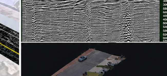
3D site environment with interpreted underground utilities

Deliverable · 3D

One coordinated 3D model.

A 3D file is not the investigation. This is the investigation, issued as files design can use.

The deliverable: an interactive 3D project, KML and the site point cloud. This page is what you open in the next drawing.

A 3D file is not the investigation

Anyone can dump a point cloud in a viewer. The work is getting GPR, EMI and the captured site into the same frame, then interpreting what the volume actually shows.

Aus-OMI issues an interactive 3D project for review, classified utility models for design coordination, KML for a light look, and the point cloud for measurement. The PDF is the decision front-end of that package.

Where it is used

  • Design coordination and clash awareness
  • Stakeholder review without a CAD seat
  • Corridors and precincts where 2D plans lie about depth

Limits we will say out loud

  • A pretty model with no evidence trail is still a guess. Ours carries the radar and the confidence with it.

Equipment is how we get there. The product is a better understanding of the site before you excavate, design or decide.

Next

Send the drawings.
We reduce uncertainty before works begin.

Corridor, precinct, brownfield or a street with no records. Brief us from Adelaide. We work Australia-wide.